Exhibition category
Contact address
| URL | https://www.spcsft.com/en |
|---|
Main exhibits 1
Satellite Data Analysis Service
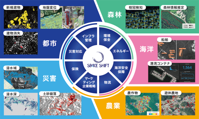
Space Shift develops and provides AI algorithms to analyze satellite data in order to capture all changes on Earth. We are developing technologies in the following areas and are in the process of introducing POC and services.
【Disaster 】
Satellite data can be used to estimate flood areas and depths and landslide areas after heavy rains. In addition to AI-based determination of flood areas and depths, the combination of ground data can provide highly accurate information, and in the determination of landslide areas, it can lead to a quick understanding of damage conditions such as road closures.
【City】
Satellite data can be analyzed by AI to detect newly constructed buildings and buildings that have been disappeared due to demolition or other reasons. This technology can be used to understand the development status of urban areas.
【Agriculture】
The combined analysis of SAR and optical satellites enables us to monitor the growth status of crops and predict the timing and quantity of harvests. By linking this information with all kinds of information in the supply chain, we can improve the efficiency of production and distribution, thereby contributing to smart agriculture.
【Marine】
Satellite data analysis can be used to monitor container operations at ports, detect suspicious ships, and detect oil slicks on the sea. It is expected to be used to optimize shipping routes and search for undersea resources.
【Forest / Biodiversity】
We are developing technology to detect tree canopy from satellite data and use this data to estimate forest inventory and CO2 absorption. Satellite data can be used for extensive and continuous monitoring. It is expected to be utilized for forest resource management and carbon credit creation.
【New Technology】
We are developing technologies to directly analyze RAW data obtained from SAR satellites and technologies to analyze multiple types of satellite data in a combined manner (Virtual Constellation).

Main exhibits 2
Displacement Analysis Service
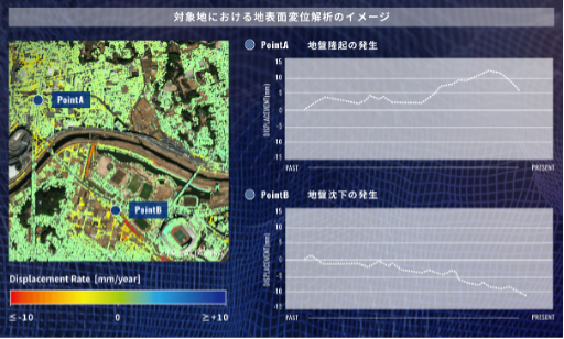
We provide interferometric SAR technology (SqueeSAR™) that can visualize the tilt of building units in addition to millimeter-scale subsidence and uplift of the ground surface.
【Use Cases】
For Municipalities (utilization for land management and disaster management)
Ground displacement conditions in areas under control or where embankments have been made can be determined on a millimeter-by-millimeter basis for use in land risk analysis and disaster prevention and mitigation measures.
For Construction companies (utilization for construction and management planning)
Through preliminary investigation of ground displacement in the proposed construction site and monitoring during and after construction, a safe construction and management plan can be established and operated. In addition, the number of leveling surveys and measurement points can be reduced.
For Infrastructure management company (Improving the efficiency of the infrastructure management system)
Safe and efficient infrastructure management is possible through monitoring of displacement and surrounding environment of your own infrastructure such as airports, bridges, tunnels, and power plants. Monitoring over a fixed period of time can distinguish between seasonal variations and abnormal displacement, and help determine priority areas for maintenance. In addition, the number of leveling surveys and measurement points can be reduced.

Main exhibits 3
SateLab (business co-creation program)
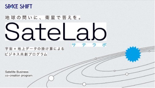
SateLab is a program to co-create unprecedented new businesses by combining satellite data with ground data. As a program led by the private sector, it places particular emphasis on accelerating social implementation and actual business. Rather than a community that holds regular meetings and events, the program focuses on business development and implementation of services and solutions by becoming a co-creation partner with companies participating in the space industry.


