

Exhibition category
Contact address
| Address | Toyosu Center Building Annex, 3-9 Toyosu 3-Chome |
|---|---|
| URL | https://www.aw3d.jp/en/ |
| aw3d_sales@kits.nttdata.co.jp |
Main exhibits 1
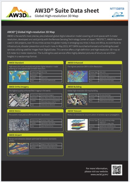
AW3D: Global High-Resolution 3D Map
AW3D is the world’s leading, high-resolution 3D map covering all land spaces with 5m resolution. In urban areas, we offer even higher detail with 0.5m resolution 3D data.
Developed jointly with NTT DATA Japan Corporation and the Remote Sensing Technology Center of Japan (RESTEC), AW3D provides comprehensive global coverage. Additionally, we offer highly detailed 0.5m and 2m resolution 3D maps using advanced satellite imagery from Maxar Technologies.
AW3D has been utilized in over 4,000 projects across 130 countries, supporting infrastructure, disaster prevention, and more.
AW3D_SuiteDatasheet (PDF file - 478KB)
Main exhibits 2
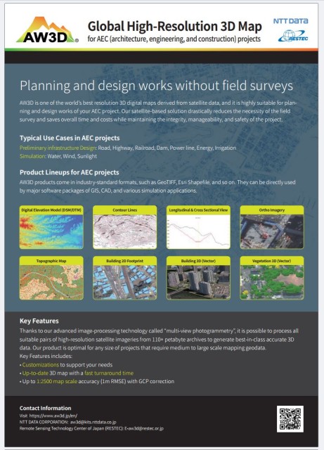
AW3D: Revolutionize Your AEC Projects
AW3D offers unparalleled high-resolution 3D maps derived from satellite data.
Ideal for architecture, engineering, and construction (AEC) projects, it streamlines planning and design. By significantly reducing the need for on-site surveys, AW3D saves time and costs while ensuring project integrity, manageability, and safety.
Key Benefits:
-Accelerated Project Delivery: Streamline planning and design processes.
-Cost Reduction: Minimize field surveys and associated expenses.
-Enhanced Decision Making: Visualize complex terrain and structures.
-Risk Mitigation: Identify potential challenges early in the project.
AW3D_AECUseCase (PDF file - 1,543KB)
Main exhibits 3
AW3D Building: Scalable, Accurate 3D Vector GeoData
AW3D Building offers unparalleled 3D vector geo-data, providing a scalable, affordable, and consistent foundation for your projects.
Derived from Maxar’s vast satellite imagery archive, our data includes detailed building footprints and heights.
Ideal for various simulations including 5G network planning and environmental research, AW3D Building data accelerates project timelines and reduces costs. With customizable texture options, our data is perfect for visual simulations and entertainment applications.
Easily update or create new city models with our efficient data format.
Experience the power of AW3D Building and transform your projects today.
