
Exhibition category
Contact address
| Address | Miyoshi 3-10-3, Koto-Ku, Tokyo, Japan |
|---|---|
| Telephone | 0368111355 |
| URL | https://synspective.com/ |
| mkt@synspective.com |
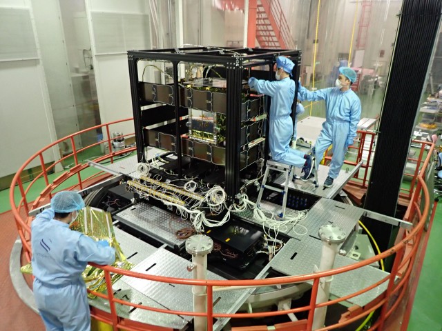
Main exhibits 1
Small SAR Satellite "StriX"
Synspective’s small SAR satellite technology originated from a Japanese government-led R&D initiative, ImPACT Program, which aimed to address the societal issue of insufficient information gathering capabilities for emergency response.

Company Brochour (PDF file - 4,317KB)
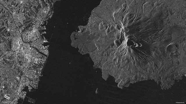
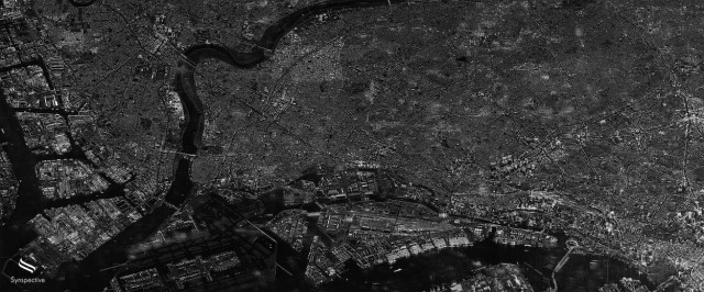
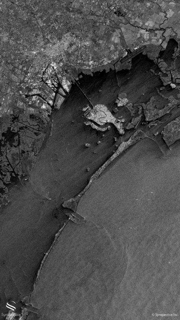
Main exhibits 2
Synspective SAR Data
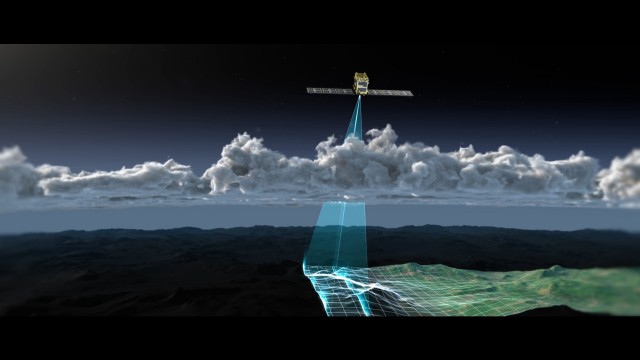
SAR satellites utilize advanced radar technology to capture the earth surface. One of the key advantages of using microwave signals is their ability to penetrate through clouds and weather conditions.
Our StriX satellites offer two observation modes: Stripmap and Sliding Spotlight. The choice of mode reflects the priority placed on either area or resolution.
1) Stripmap Mode
In this mode, the center of the antenna beam moves in conjunction with the satellite, illuminating the ground with a sequence of electromagnetic pulses. The outcome is a long swath image with a nominal slant-range resolution of 1.8 meters and a nominal slant-azimuth resolution of 2.6 meters. Stripmap is the optimal mode for large-area capture.
2) Sliding Spotlight Mode
In this mode, the antenna beam is steered during data acquisition to allow a longer observation of a selected area. Because the antenna beam moves at a slower rate, more data is collected, resulting in a nominal slant-range resolution of 0.5 meters and a nominal slant-azimuth resolution of 0.9 meters. Sliding Spotlight is the optimal mode for high-resolution capture.
SAR Data Product Guide (PDF file - 479KB)
Main exhibits 3
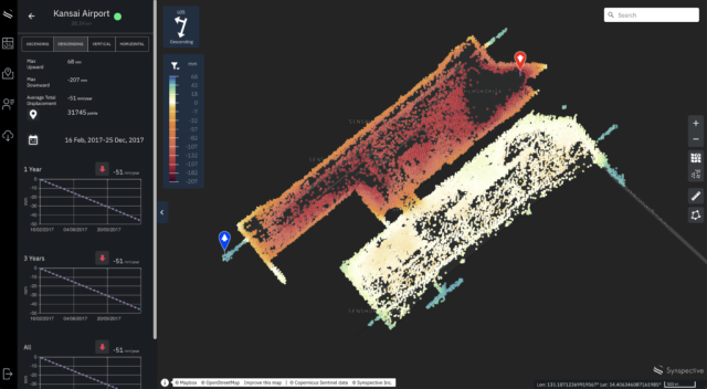
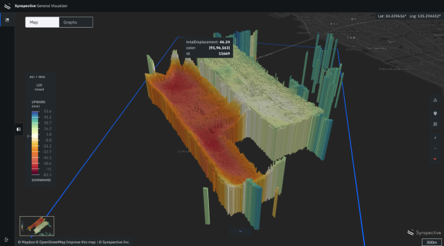
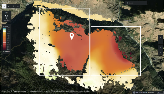
Land Displacement Monitoring (LDM)
Land Displacement Monitoring Solution originated from InSAR* analysis and is capable of detecting timely vertical land displacement in millimeters, over a wide area. In addition, this service enables periodical observation and understanding of land subsidence and deformation.
*InSAR:Interferometric SAR. The technology to detect land displacement with mm accuracy.